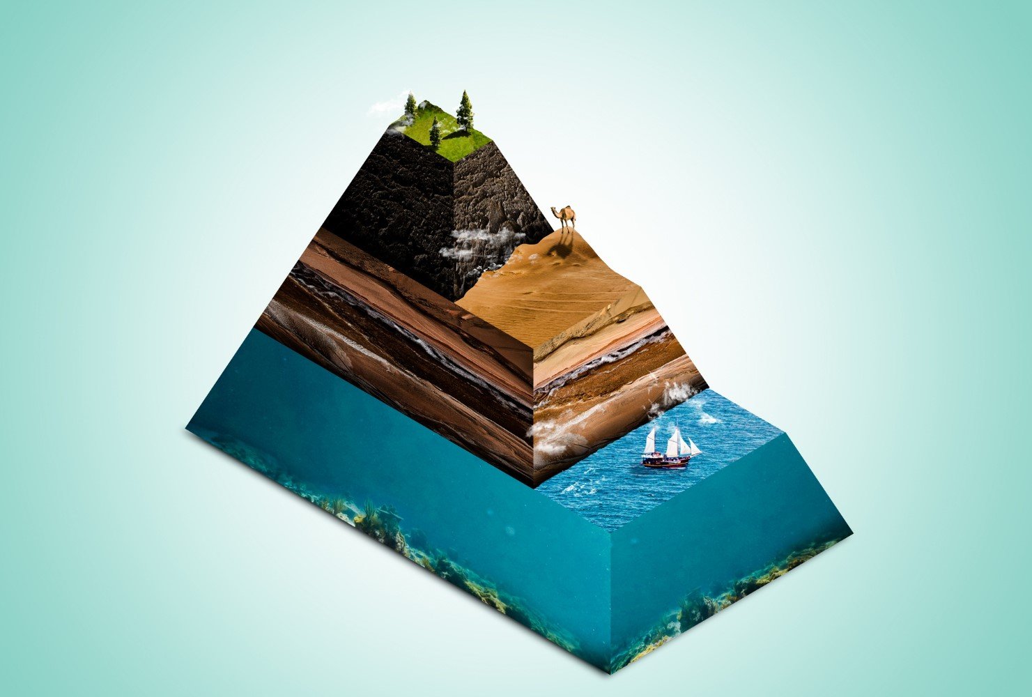
middleportal.com – Using a model to represent Earth’s layers offers several advantages that aid in understanding the composition and structure of our planet. However, models also have some limitations that need to be considered. In this article, we will explore the benefits and drawbacks of using models to represent Earth’s layers.
Benefits of Using a Model to Represent Earth’s Layers
A model is a simplified representation of a complex system or phenomenon. By using a model, we can abstract and highlight the essential features of the system or phenomenon, making it easier to study and analyze. Some of the benefits of using a model to represent Earth’s layers are:
Shows distinct layers
A model provides a visual representation of the distinct layers that make up Earth, such as the crust, mantle, outer core, and inner core. This clear differentiation allows us to comprehend the complexity and organization of our planet’s interior. For example, a model can show us how the crust is divided into continental and oceanic plates, how the mantle is composed of solid and molten rock, and how the core is made of iron and nickel.
Gives a better idea of how the Earth looks
By utilizing a model, we can gain a more comprehensive understanding of the Earth’s physical appearance. It enables us to visualize the relative sizes and positions of the different layers, providing a more accurate depiction of our planet’s internal structure. For instance, a model can show us that the crust is the thinnest layer, accounting for only about 1% of the Earth’s volume, while the mantle is the thickest layer, occupying about 84% of the Earth’s volume.
Helps learn about the geography of the Earth
A model representing Earth’s layers aids in studying the geography of our planet. It allows scientists to analyze how the distribution of landmasses, oceans, and other geological features interact with the various layers of the Earth, contributing to our knowledge of Earth’s dynamic processes. For example, a model can help us understand how plate tectonics, the movement of the crustal plates, affects the formation of mountains, volcanoes, earthquakes, and continental drift.
Assists scientists in making predictions
Models help scientists make predictions about Earth’s behavior and phenomena. By incorporating data and observations into a model, scientists can simulate and forecast geological events, such as earthquakes and volcanic eruptions, enabling better preparedness and mitigation strategies. For instance, a model can help us estimate the magnitude and location of an earthquake by measuring the seismic waves that travel through the Earth’s layers.
Limitations of Using a Model to Represent Earth’s Layers
While models are valuable tools in understanding Earth’s layers, they also have certain limitations. Some of these limitations include:
Not to scale
Models often cannot accurately represent the true scale of Earth’s layers. Due to the vast differences in size between the various layers, it is challenging to create a model that accurately portrays their relative proportions. For example, a model may show the crust and the core as having similar thicknesses, while in reality, the core is about 55 times thicker than the crust.
Shows limited information in terms of temperature and pressure
Models typically do not provide detailed information about the temperature and pressure variations within Earth’s layers. These factors play crucial roles in understanding the behavior and characteristics of each layer. For example, a model may not show how the temperature increases from about 15°C at the surface to about 6000°C at the center of the Earth, or how the pressure rises from about 1 atmosphere at the surface to about 3.6 million atmospheres at the center of the Earth.
Can’t determine the type of material in the layers
Models alone cannot reveal the specific composition of each layer. While they can represent the distinct layers, they do not provide information about the materials that constitute them. For example, a model may not show how the crust is made of various types of rocks, such as granite, basalt, and sandstone, or how the mantle is composed of different minerals, such as olivine, pyroxene, and peridotite.
Cannot show the proper order of Earth’s layers
Models may not accurately depict the sequential arrangement of Earth’s layers. This limitation can hinder a complete understanding of the hierarchical structure of our planet. For example, a model may not show how the crust is the outermost layer, followed by the mantle, the outer core, and the inner core, or how the mantle is subdivided into the upper mantle, the transition zone, the lower mantle, and the D’’ layer.
Only shows the different layers of Earth’s interior
Models primarily focus on representing the layers within the Earth’s interior, often excluding the atmosphere. This omission limits the comprehensive understanding of Earth’s entire structure. For example, a model may not show how the atmosphere is composed of several layers, such as the troposphere, the stratosphere, the mesosphere, the thermosphere, and the exosphere, or how the atmosphere protects the Earth from harmful radiation and meteoroids.
Fails to display the distribution of continents accurately
Models may not accurately represent the distribution and positioning of continents on Earth’s surface. This limitation can impact our understanding of plate tectonics and the movement of landmasses over time. For example, a model may not show how the continents are not fixed, but rather drift slowly across the Earth’s surface, or how the continents were once joined together in a supercontinent called Pangaea.
Does not accurately show the Earth’s magnetic field
Models generally do not incorporate the Earth’s magnetic field, which is an essential component of our planet’s overall structure. This exclusion limits our understanding of Earth’s magnetic properties and their influence on various geological processes. For example, a model may not show how the Earth’s magnetic field is generated by the electric currents in the outer core, or how the magnetic field protects the Earth from the solar wind and creates the auroras.
Conclusion
Using a model to represent Earth’s layers offers several advantages that aid in understanding the composition and structure of our planet. However, models also have some limitations that need to be considered. By understanding the benefits and limitations of using models, scientists can continue to refine their understanding of Earth’s intricate systems and phenomena.
